Exploring new ways to manage the devastation caused by floods
In many countries, new approaches to flood management are replacing traditional reactive measures.
Floods cause the greatest damage and loss of life, compared to all other natural disasters in Asia and the Pacific. Managing the risks posed by these devastating events is crucial.
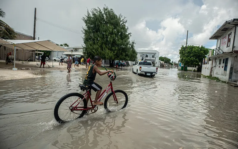
Innovative new approaches are needed to address the risks associated with flooding in Asia and the Pacific. Photo: ADB |
An estimated 2,000 water-related disasters struck Asia between 1995 and 2015, killing 332,000 persons and affecting a further 3.7 billion. This situation is made more challenging by climate, which is expected to aggravate flooding, raise sea levels and cause more severe cyclones and storm surges.
In many countries, new approaches to flood management are replacing traditional reactive measures. While integrated flood risk management principles are common, measures are different from one place to another depending on social, economic, climatic, and other geo-physical conditions. Flood risk management requires the harmonization and synergy of the principles of water resources management, climate change adaptation, and disaster risk management. All of these elements must be examined together to avoid inconsistencies.
Countermeasures that have so far been put in place to manage flood risk were developed based on know-how gleaned from the historical events. However, these measures may not be keeping pace with rapidly changing natural conditions and development priorities.
For instance, traditional measures such as large reservoirs are no longer practical or environmentally feasible. In large river basins, significant flood damage not only comes from main stem rivers, but also from urbanized small- to moderate-sized sub-basins, where highly devastating flash floods and landslides are frequent. These hazards cannot be controlled by conventional methods.
Modern flood risk management requires spatial, functional and institutional integration mainly at the river basin. Spatial integration recognizes that flood risk management (such as flood protection for a city) will modify flood risk elsewhere in the river basin, particularly downstream.
Functional integration recognizes that flood management interventions also affect other sectors of civic management (e.g., transport, agriculture, environment), and conversely that interventions in other sectors may also modify flood risk.
Institutional integration (or coordination) is a key element because multiple agencies of government have different roles in management of all relevant sectors. This prompts the need for flood footprint mapping and accountability mechanism at a river basin scale.
The flood footprint takes into account the progressive flood footprint, which is the impact of floods on different sectors; reverse flood footprint, which is the impact of sector developments on flood risk; and spatial flood footprint, which is any of the previous two flood footprints in spatial scales (i.e., at local, river basin, or beyond).
These footprints can be positive or negative in terms of their impact on flood risk management. To be a successful model, the development planning should assess the change in flood footprint.
Integration in flood risk management poses challenges but may also identify ways to optimize investment programs and produce more sustainable results. Examples are cross-sectoral projects that may combine wastewater, solid waste and flood risk management interventions, or projects that address both urban and rural services in a river basin to jointly improve water quality, reduce flood risk and create spaces for community amenities.
Identification of a nexus between flood and environment and ecosystems must guide modern flood risk management. How we manage floods changes the environment of rivers and floodplains, since it can degrade water quality, or render river channels unstable. It can also change the seasonal and spatial distribution of water. Those environmental changes can then jeopardize the sustainability of ecosystems and the services they provide (fish, food, and fiber).
Flood and environmental risk management can help factor risk to the environment into project planning and implementation. Associated with flood and environmental risk management is the use of natural processes to mitigate flooding, referred to as green measures – as opposed to the grey measures of engineering works.
These can retain floodplain storage and make room for rivers to flood. They can also include urban stormwater measures to divert water to soil and groundwater, and offset or capture or reuse increased runoff from impervious surfaces like roofs and paved roads.
Flood risk management strategies should recognize that climate change is just one of several factors that can influence the future impact of floods. Other factors include population growth, industrial development, land use change, and physical conditions and vegetation cover of upper watersheds.
Planning for these impacts requires making reasonable assumptions, analyzing trends, undertaking sensitivity analysis, and assigning confidence limits.
Flood risk management on its own does not offer flood protection. But better planning and designing of the development of the river basin can mitigate the flood risk significantly. In this context, a participatory approach is certainly key to success.
We need to evaluate the gaps and challenges of ongoing efforts and pursue flood and environmental risk management to lessen the impact of these devastating events.
Rabindra P. Osti is Senior Water Resources Specialist, East Asia Department, ADB.


