Hanoi needs to speed up the construction of data infrastructure and accelerate the digital transformation process for urban planning, said Vo Chi My, Vice President of the Vietnam Association of Geodesy, Cartography and Remote Sensing, on October 1.
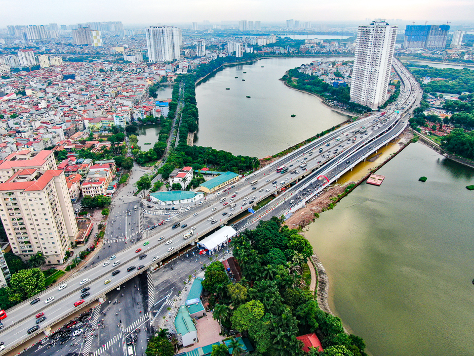
| The viaduct of Ring Road No. 3 crossing the Linh Dam peninsula in Hoang Mai district. Photo: Trung Nguyen/The Hanoi Times |
Speaking at a seminar titled 'Hanoi - 70 Years of Planning, Architecture and Urban Development', My emphasized that the digital transformation process must be comprehensive.
My argued that digital transformation is the fastest way to achieve a breakthrough and enable Hanoi to develop into a modern, smart city.
Nguyen Quang, former Director of UN-Habitat Vietnam, said that Hanoi is a city with significant heritage.
Tangible and intangible cultural heritage should be treated as social assets, which are key to contributing to the city's identity, improving the quality of life and boosting the city's economy, he said.
Quang also noted that Hanoi's urban development requires a connection between the renovation of central areas and suburban regions, including the restoration of the ecosystem of lakes and public spaces.
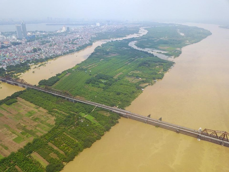
He stressed the importance of harnessing the development potential of the Red River as an ecological axis for Hanoi.
Speaking about the rivers, Marco Buinhass, Design Director of the international consulting firm enCity, said that the Red River and other rivers are important in making Hanoi a sustainable, green and eco-friendly metropolis.
Buinhass proposed a three-phase action plan to restore the ecosystem, reconnect people with the river, and regenerate opportunities.
According to the foreign expert, the ecological restoration of the Red River is the first step in realizing the vision of transforming the river corridor into a flood mitigation zone, enhancing ecological functions, and harnessing the potential of a green development axis for central Hanoi.
He also proposed the development of a barrier-free infrastructure system to ensure comprehensive access and proper urban integration with the Red River dyke system.
He added that accessibility and connectivity will be crucial to the future development of the new central development axis, integrating transport systems and connecting waterways, bus routes and soft transport corridors.
Finally, regeneration opportunities include creating new housing models to meet demand, upgrading informal settlements outside the levee system, and transforming stagnant water zones into a dynamic riverine regime that contributes to sustainable socio-economic and environmental development, the executive said.
Dao Ngoc Nghiem, Vice President of the Vietnam Association of Urban Planning and Development, emphasized that urban planning requires a multidisciplinary approach and joint efforts from the public, political and professional organizations.
He recommended that Hanoi focus on the harmonious development of both urban and rural areas to achieve its goal of becoming a special metropolis by 2030, while recognizing and preserving its traditional values.
To address Hanoi's short- and long-term challenges, the Hanoi Party Committee has issued 10 comprehensive work programs and specific plans, according to Duong Duc Tuan, Deputy Chairman of the Hanoi People's Committee.
Tuan said Hanoi will submit the two overall urban and socio-economic growth plans for 2021-2065 to the Prime Minister for approval in early October 2024.
Under the two plans, Hanoi will develop five spatial axes and build new satellite cities, using the Red and Duong Rivers as the backbone for all socio-economic activities. The city also plans to build a new international airport in its southern part.
Hanoi authorities will speed up the development of specific plans to implement the overall plans and complete infrastructure construction at the same time, he said.
The 2024 Capital Law and its sub-regulations will also help resolve difficulties in various sectors and hold individuals and organizations accountable, Tuan said.
Challenges in urban planning and architectural design
| The Red River in Hanoi. Photo: Hai Linh/The Hanoi Times |
At the conference, experts pointed out that although Hanoi's urban planning and architecture management has been flexible and innovative, challenges remain.
According to Nghiem, urban planning and architecture have been crucial to Hanoi's socio-economic development since its liberation on October 10, 1954.
"In 70 years, Hanoi has adjusted its administrative boundaries four times and adopted seven urban master plans," he said.
However, insufficient resources and poor management remain the two biggest challenges for the capital, the architect said.
Former UN Habitat Vietnam Director Quang said Hanoi has developed rapidly, with its population swelling by 12.5 times and its land area expanding by 22 times between 1960 and 2020.
However, the capital's urbanization progress remains slow and Hanoi is still considered a province by urban standards, he said.
"Hanoi is known as the land of traditional handicraft villages, but handicraft production causes severe pollution of lakes, rivers and air," he added.
Despite a distinctive ecosystem of ponds, lakes and rivers, Hanoi still faces frequent flooding problems, Quang said.
Other shortcomings include traffic congestion, inappropriate housing, and a lack of public amenities and disaster response capacity, said the former director of UN Habitat Vietnam.
Hanoi also faces challenges in developing its satellite city network, said Nguyen Trong Ky Anh, Director of the Hanoi Department of Planning and Architecture.
Hanoi is expected to develop into a metropolis with a central city, five satellite towns, three eco-friendly towns, and nine rural districts and towns, he said.
The green corridor, consisting of eco-friendly and rural areas, serves as a buffer zone between urban areas, improving the city's environment, he said.
But more than a decade later, the satellite city structure has yet to materialize, Anh said, noting that the city has not achieved its urbanization goals.
Investors have failed to capitalize on the specific strengths and characteristics of these areas, while technical and social infrastructure has not kept pace with development, he explained.
"The imbalance in the distribution of economic sectors has led to real estate bubbles and abandoned projects," the director said.
"The relocation of universities, medical facilities, and educational institutions is ineffective, while green spaces, underground spaces, and public spaces receive insufficient investment and attention," Ky Anh added.