To realize the goal of developing the Red River into a key urban landscape axis for the capital, districts in Hanoi are expediting the establishment of a detailed zoning plan for the Red River urban area.
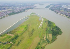
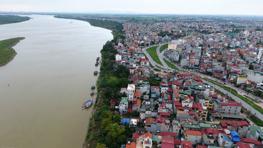
| Red River sub-area from above. Photo: Thanh Hai/The Hanoi Times |
Nguyen Thi Nga, a resident of 587 Nguyen Khoai Street, Thanh Tri Ward, Hoang Mai District, stated that the Hanoi People's Committee's approval of the zoning plan for the Red River urban sub-area is of great relevance to long-time residents.
“We have been living here for a long time, but with this, we would finally be considered to be living here legally," Nga said. However, more than two years since the 1/5,000 scale plan's approval, detailed 1/500 scale plans for existing residential areas, which would formalize land use rights and provide a basis for issuing land use certificates and construction permits, have yet to be approved. This delay has affected local residents' lives.
Without detailed plans, residents, even those whose land is fully documented and uncontested, cannot obtain land use certificates (title deeds). Many riparian households along the Red River dyke have "red books" (land use certificates), but multi-generational families wishing to build new homes or renovate aging structures are not permitted to do so.
Tran Van Lai, Secretary and Head of Residential Group No.5 in Thanh Tri Ward, Hoang Mai District, reported that all 600 households with nearly 3,000 residents live outside the dyke. Without detailed plans, residents cannot repair their homes, and during the rainy season, they must inspect and assess dilapidated houses at risk of collapse and report to authorities to ensure safety.
"The land outside the dyke is primarily residential, passed down through generations. Residents hope that authorities will soon approve detailed plans for the Red River urban area to stabilize their lives and allow for home repairs and new constructions. They also hope for investment in public infrastructure such as roads, electricity, schools, and medical facilities," Lai said.
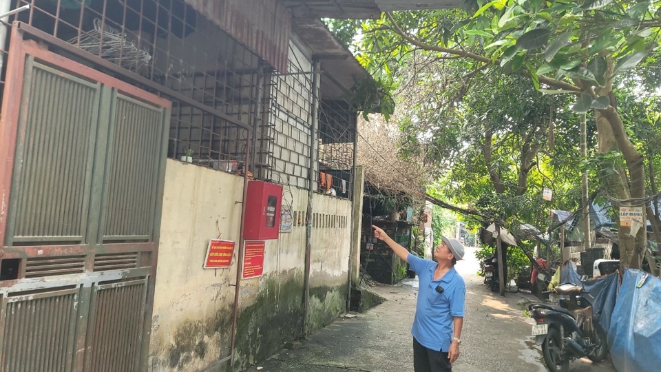
| Locals at Thanh Tri Ward, Hoang Mai District could not acquire construction permits to repair their houses due to living out of the planning zone. Photo: Huy An |
The district has instructed relevant units to coordinate with Thanh Tri, Linh Nam, and Tran Phu wards to review and detail riverside areas. The 1/5,000 scale plan approved by the city is a crucial foundation for defining the boundaries of existing residential areas at a 1/500 scale.
From January 17 to February 29, Thanh Tri Ward People's Committee posted documents and maps for public feedback on the 1/500 scale zoning plan for existing residential areas outside the dyke. Feedback forms were distributed to residents in the riverfront areas. Meetings were held to gather and summarize public opinions, most of which supported the detailed plan and called for practical surveys for suitable planning.
The Urban Management Department of Hoang Mai District reported that the 1/500 scale zoning plan for the Red River urban area is in its final stages. On January 5, 2024, the department, in coordination with ward authorities, consultants, and related units, held a meeting to collect feedback from agencies, organizations, individuals, and community representatives from Thanh Tri, Linh Nam, and Tran Phu wards.
The Hoang Mai District People's Committee has sought approval from the Hanoi Department of Planning and Architecture, as required by the Urban Planning Law.
"Once we have the consent from the Hanoi Department of Agriculture and Rural Development on the boundaries of the existing residential areas and from the Department of Planning and Architecture, the district will complete the 1/500 scale detailed plan for existing residential areas outside the dyke in Thanh Tri, Linh Nam, and Tran Phu wards for submission to the planning appraisal council," it noted.
On March 25, 2022, the Hanoi People's Committee issued Decision No. 1045/QD-UBND, approving the 1/5,000 scale zoning plan for the Red River urban area, covering 55 wards and communes across 13 districts. Following the approval, the Hanoi People's Committee tasked the People's Committees of the 13 districts and the Department of Agriculture and Rural Development with devising 1/500 scale boundary maps for existing residential areas, 1/500 scale detailed plans for these areas, and determining specific legal land use for each plot. This process serves as the basis for issuing land use certificates and construction permits according to regulations. Additionally, authorities are to monitor, manage, and supervise construction in accordance with the zoning plan and deal with any unauthorized construction as per legal authority and regulations. They are also to review and adjust related programs, plans, zoning, and investment projects in the area to be consistent with the approved sub-area zoning plan. |