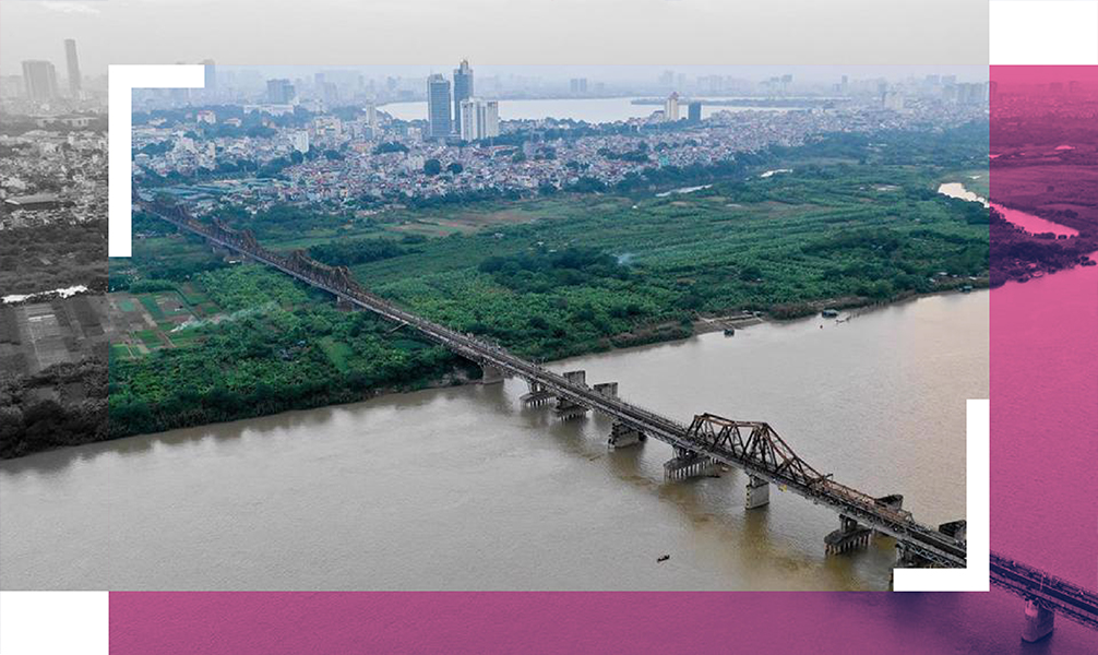
[Hanoi thriving] Dream of a riverside city
The Red River Zoning Plan will make Hanoi become green and modern urban city.
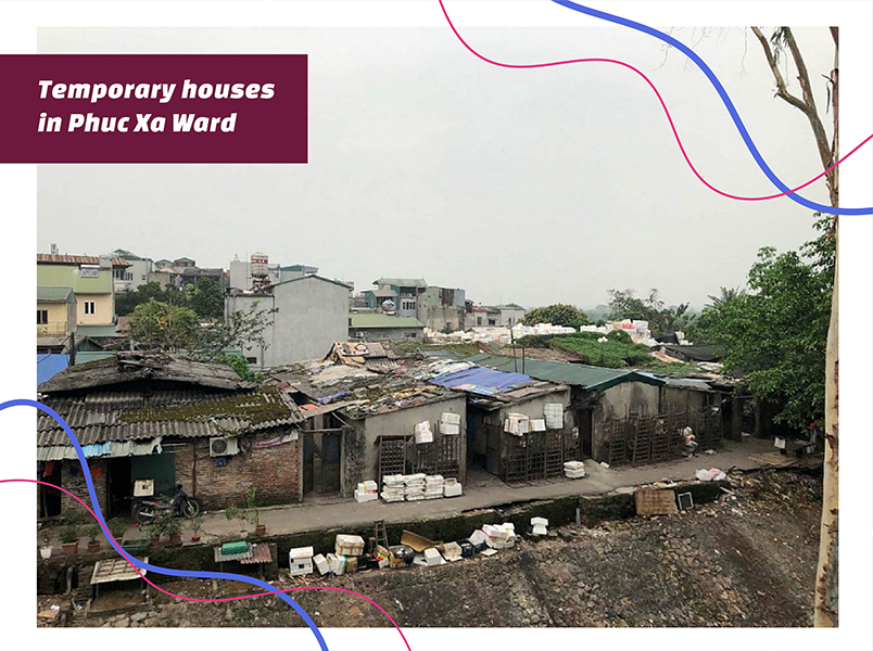
Living in the riparian areas in An Xa Street, Phuc Xa Ward for nearly 30 years, Nguyen Quang Trung, 52, takes a sigh of relief upon hearing the city’s announcement of the planning.
“Things have changed so much since the time I moved here when the surrounding was just a landfill, but what has remained the same is the ban on renovating our houses, our request to repair it was consistently denied,” Trung told The Hanoi Times, referring to the fact that the law prohibits the construction of permanent buildings outside the dyke systems.
“The approval of the planning is great news for us. I hope the project could get started soon,” Trung added.
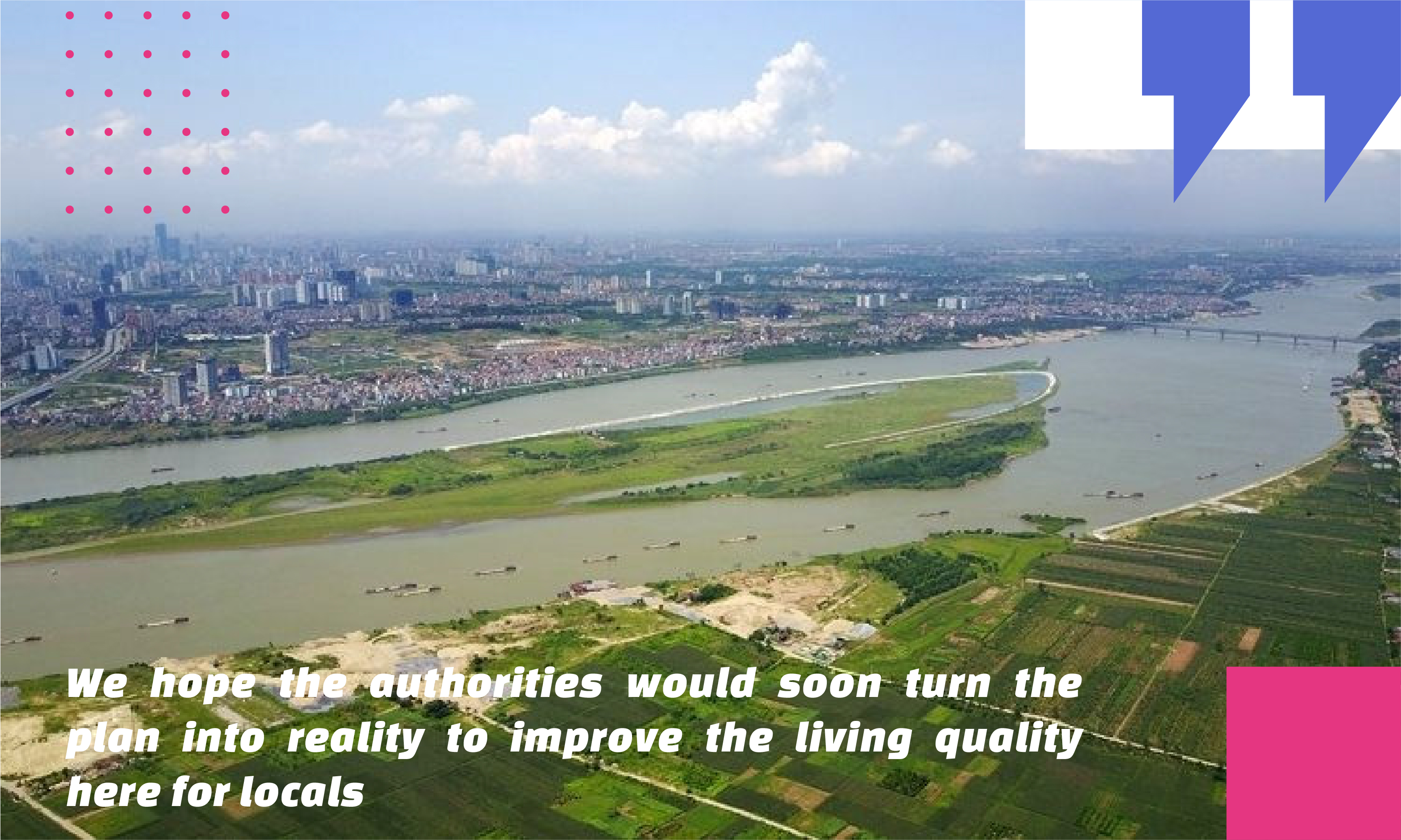
A few blocks away, Nguyen Thi Tuyet shared the neighbors’ sentiment while pointing at her old house that has been ravaged by time.
“We don’t care if we have to relocate or stay here. But we no longer bear to live in uncertainty. We hope the authorities would soon turn the plan into reality to improve the living quality here for locals,” Tuyet told The Hanoi Times.
What Tuyet said is also the yearning of nearly 244,000 people living in the riparian areas along the two banks of the Red River, and hope one day they could be settled here rightfully.
Being aware of the people’s desire, the Municipal Government for years has planned the transformation of two banks of the Red River into modern and urban spaces, considering it a long-term vision for Hanoi, but a combination of legal entanglement, technical solutions unavailability, and budget constraint has hindered the move until now.

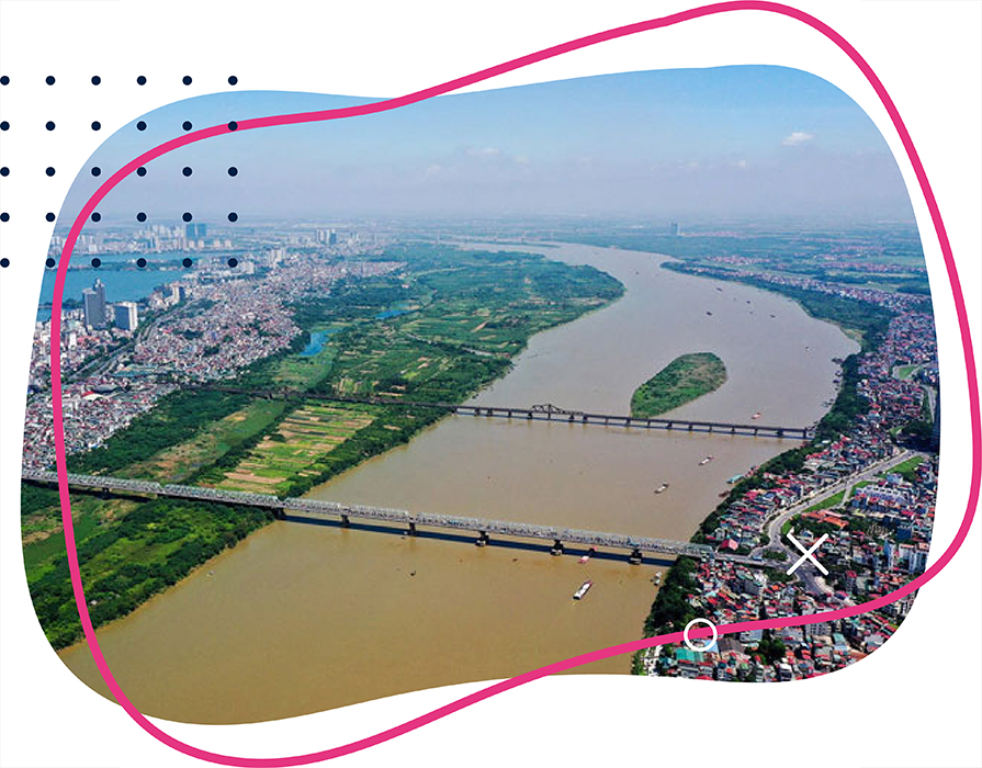
In late March, the Hanoi People’s Committee issued decision No.1045 approving the Red River Zoning plan at a scale of 1/5000, covering an area of nearly 11,000 hectares in 55 wards of 13 districts.
Under the plan, the new urban space along the two sides of the Red River would stretch 40 kilometers, from Hong Ha Bridge to Me So Bridge under the jurisdiction of 55 wards of 13 districts including Hoan Kiem, Ba Dinh, Tay Ho, Bac Tu Liem, Hai Ba Trung, Hoang Mai, Long Bien, Dan Phuong, Me Linh, Dong Anh, Gia Lam, Thuong Tin, and Thanh Tri.
This urban space would be a flood drainage for the downtown area, which has been stipulated under the city’s construction planning until 2030, with a vision of 2050.
By 2030, the population in these areas is estimated to be around 300,000, including 85,000 new residents.
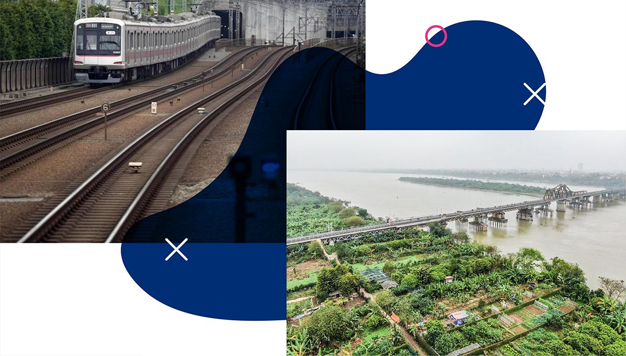
In addition, it is set to become a green landscape with public spaces for cultural and tourism purposes, for which the city would invest in a network of transport and technical infrastructure to bolster connectivity in terms of road and waterways with neighboring areas.
Vice Director of the municipal Planning – Architecture Department Pham Quoc Tuyen at the launch of the planning in early April expected it would serve as the legal basis to help the people maintain their livelihoods, preserve historical and cultural heritage sites, as well as enhance the utilization of available land funds to create urban landscape alongside the Red River.
“The planning would meet people’s desire to settle rightfully in the riparian areas outside the dyke system in the long term,” he said.
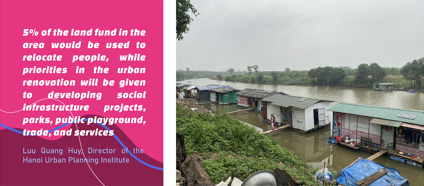
The view is shared by the Director of the Hanoi Urban Planning Institute Luu Quang Huy, noting a key part of the plan is to preserve the historical values and relocate people living in the riparian areas.
“5% of the land fund in the area would be used to relocate people, while priorities in the urban renovation will be given to developing social infrastructure projects, parks, public playground, trade, and services,” Huy said.

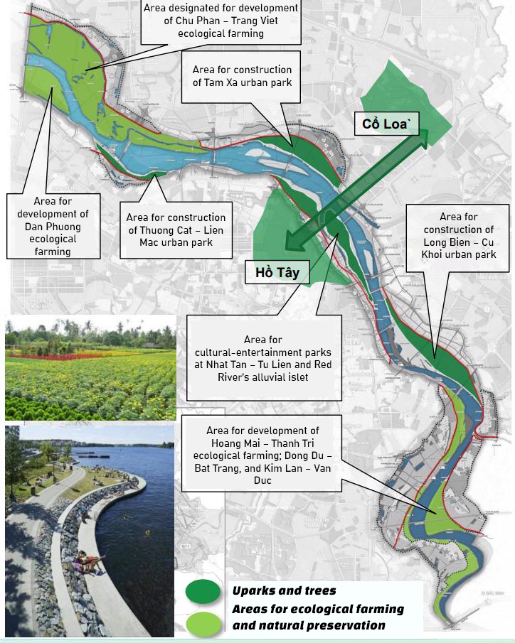
The first section (R1-R2) would start from Hong Ha Bridge to Thang Long Bridge, which will become an eco-urban area for nature preservation based on existing villages and farmlands in rural districts of Dong Anh, Me Linh, Dan Phuong, and Bac Tu Liem.
These areas are set to become eco-parks for tourism.
The area from Thang Long Bridge to Thanh Tri Bridge (R3-R4) is the center of the Red River urban spaces, with the north including urbanized villages of Dong Anh and Long Bien districts, and the south consisting of urban districts such as Tay Ho, Ba Dinh, Hoan Kiem, Hai Ba Trung, and Hoang Mai.
Under the plan, this section will be home to multi-function areas with public cultural buildings, trade, services, and entertainment that include the historical sites of West Lake and Co Loa.
The third section (R5) from Thanh Tri Bridge to Me So Bridge, is the main eco-space of the Red River Zoning plan, which consists of farming and fish farming areas of traditional cultural villages and historical sites.
.jpg)
In devising the plan, the city aims to preserve and restore the natural and cultural values for tourism development, along with building multi-functional zones for trade, services, and logistics services at Thanh Tri and Bat Trang ports.

With such ambitious goals set out in the Red River Zoning Plan, many expect it would be groundbreaking in transforming Hanoi in the short term.
“For the past few years, urban planning and development have been the city’s priority to further boost socio-economic development,” Vice Chairman of the Hanoi People’s Committee Duong Duc Tuan told The Hanoi Times.
.jpg)
“The zoning plan for Red River is the last puzzle to complete the planning process for the entire city,” he said, expecting this would be the legal basis for more detailed planning at a smaller scale, a step to turn the vision into reality.
“People’s livelihood would no doubt be improved with greater modernization and civilization,” he added.
Chief of Office of the Vietnam Association of Architects Pham Thanh Tung said the zoning plan is not only the desire of those living in the riparian areas but also every Hanoian.

“The zoning plan would speed up the ongoing revision of the whole construction planning for Hanoi and contribute to the city’s sustainable growth. This is especially significant given the fact that many downtown districts no longer have sufficient land funds for social welfare purposes,” Tung told The Hanoi Times.
Tung, however, noted the next step for Hanoi is to mobilize the investment capital required to materialize the plan.
“A key challenge for Hanoi is to create better livelihoods for thousands of people, who have been living in the riparian areas for decades without legal recognition and facing the lack of access to adequate public infrastructure or services,” Tung said.
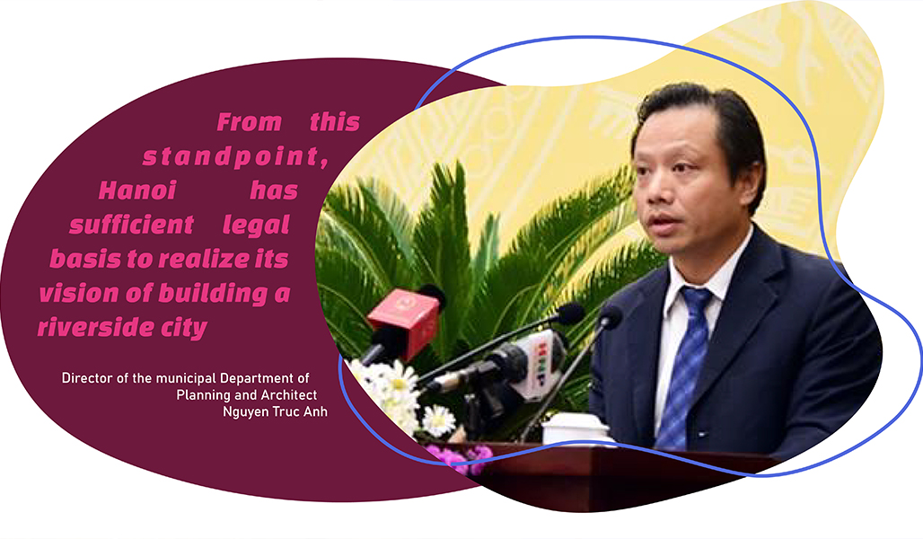
Echoing Tung’s view, the Director of the municipal Department of Planning and Architect Nguyen Truc Anh noted the city’s decision to approve the planning offers a huge opportunity for Hanoi to develop into a green and modern urban city while solving the livelihood concern of people in the riparian areas.
“From this standpoint, Hanoi has sufficient legal basis to realize its vision of building a riverside city,” Anh told The Hanoi Times.