Airport-based urban model proposed for Red River’s northern region
Hanoi faces increasing challenges posed by rapid urbanization and needs a new growth engine to advance development.
Experts are calling for Hanoi’s authorities to consider setting up an airport-based urban model in the North of the Red River to create a new growth engine for the capital.
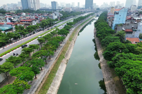
| The north of the Red river, including Me Linh, Dong Anh, and Long Bien districts, could potentially become a new growth engine for Hanoi. Photo: Trung Nguyen |
.jpeg)
Such a model has now become a common trend in the world, with prime examples being Changi (Singapore), Incheon (South Korea), Dubai (UAE), and Frankfurt (Germany).
The successful stories of Changi or Dubai showed the direction of metropolitan cities by taking a polycentric approach and creating a new growth engine with greater flexibility and competitiveness.
According to experts, the airport-based urban model would consist of an airport, a multifunctional metropolitan area, an interchange for highways, pedestrian walkways, metro or BRT, and surrounding residential areas.
Released ten years ago, the Government's Decision No.1259 approving a master construction planning on Hanoi to 2030, with a vision to 2050, has envisioned the city's development as a model of the urban cluster. The model includes the metropolitan area and five satellite towns interconnected by transport systems of ring roads and centripetal axes linking with national and regional transportation networks.
While the planning, in theory, shows an ideal Hanoi in the future, it is proving to be an increasingly difficult task, given Hanoi today is facing numerous challenges in terms of rising population, overloaded infrastructure, traffic congestion, and degraded environmental quality.
This, in turn, requires the city to have more practical and cautious solutions.
Vice General Secretary of the Vietnam Urban Planning and Development Association (VUPDA) Truong Van Quang told The Hanoi Times that Hanoi should turn to a breakthrough approach in line with its current urbanization process, especially revision in the function of satellite cities with the airport-based urban model.
According to Quang, the combination of the two models are suitable in the north of the Red River, including Dong Anh, Me Linh, and Soc Son, which are close to the Noi Bai International Airport.
"These locations are closely connected to the national infrastructure framework and dynamic economic hubs," Quang said, referring to the economic corridor Kunming (China) – Lao Cai – Hanoi – Haiphong – Quang Ninh; expressways Hanoi – Lao Cai, Hanoi – Thai Nguyen, Hanoi – Lang Son; economic zones of Vinh Phuc, Bac Ninh and Thai Nguyen.
"More importantly, these areas have sufficient land reserves, abundant workforce, and large transport infrastructure projects to meet the growing demand for growth," he continued.
Sharing Quang's view, architect La Hong Son from Hanoi's Department of Urban Planning and Architecture said the "city within city" model is compatible with the current urban cluster.
Son expected Hanoi to set up a city north of the Red River with Soc Son satellite city as the core and take advantage of the Noi Bai International Airport and the economic corridor along the national road No.18.
"This new city, along with the two neighboring cities in the north of Vinh Phuc and Bac Ninh would form a new growth engine for Hanoi Capital Zone," Son told The Hanoi Times.