Social Affairs
Typhoon Usagi weakens to tropical depression after hitting southern Vietnam
The National Center for Hydro-Meteorological Forecasting (NCHMF) issued warning of threats of landslide and flood in low-lying places and high mountainous areas.
Typhoon Usagi made landfall on Vietnam’s south central region and entered the coast of Ba Ria-Vung Tau in the morning of November 25, then dissipating into a tropical depression, according to the NCHMF.
As of 1 pm on Sunday, the tropical depression was raging along the coast from south-central Binh Thuan province to southern Ben Tre province, with maximum wind speeds of 60 kilometers per hour. It is forecast to continue moving inland before forming a low-pressure zone over the Cambodia border area at 1 am Monday, NCHMF said.
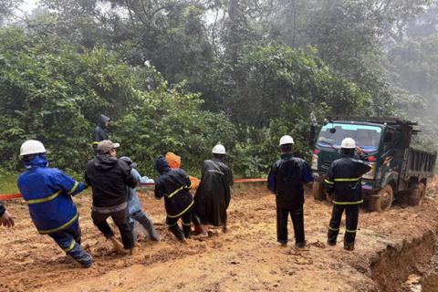
On Sunday, heavy rains were lashing the southern beach town Vung Tau and Ho Chi Minh City on the large scale. Rains have been pouring down the popular beach town, uprooting trees, blowing off dozens of roofs and sinking boats along the coast, the center reported.
By Sunday noon, the tropical low has moved to the nearby Can Gio coastal district in Ho Chi Minh City. Many places in the city suffered thunderstorms and rainfall of up to 200mm throughout Sunday, NCHMF added.
Ho Chi Minh City is warned to experience a rainfall of 200 - 250 mm, thunderstorms, cyclone and high tides on the large scale from this afternoon.
According to the latest news from NCHMF, Usagi was centered at around 9.7 degrees north latitude and 109 degrees east longitude, at about 100 kilometers of the Phu Quy Island, 180 kilometers of the Phan Thiet city, 230 kilometers of Vung Tau and 270 kilometers of Ben Tre province with its peak wind ranging 75- 100 kilometers per hour.
Within the next 24- 24 hours, Usagi is predicted to move the westward at 10-15 kilometers an hour, to make landfall in provinces from Binh Thuan to Ben Tre before it will weaken into a tropical low pressure system, the center said.
By 10am on November 26, the tropical depression will be at 10.5 degrees north latitude and 106.3 degrees east longitude in the land of southern region. The maximum wind near the center is warned to reach 40- 50 kilometers an hour, NCHMF noted.
The dangerous zone in the East Sea in the next 24 hours is paralleled in 8.5- 12.5 degrees north latitude and 112 degrees east longitude. The storm circulation in combination with cold air resulted in outbreak of heavy rain of 300- 400 mm in the southern region, 100- 200 mm in the central highlands region, the center added.
On November 27, water in rivers from Quang Tri to Binh Thuan, the southeastern and central highlands provinces is expected to rise. NCHMF issued warning of threats of landslide and flood in low-lying places and high mountainous areas.
The center has predicted another four to six typhoons and tropical depressions could develop off the country's east coast from now until the end of the year. Half of them would make landfall in and batter Vietnam’s central region.
As of 1 pm on Sunday, the tropical depression was raging along the coast from south-central Binh Thuan province to southern Ben Tre province, with maximum wind speeds of 60 kilometers per hour. It is forecast to continue moving inland before forming a low-pressure zone over the Cambodia border area at 1 am Monday, NCHMF said.

Path and position of the tropical depression. Photo: Nchmf
|
By Sunday noon, the tropical low has moved to the nearby Can Gio coastal district in Ho Chi Minh City. Many places in the city suffered thunderstorms and rainfall of up to 200mm throughout Sunday, NCHMF added.
Ho Chi Minh City is warned to experience a rainfall of 200 - 250 mm, thunderstorms, cyclone and high tides on the large scale from this afternoon.
According to the latest news from NCHMF, Usagi was centered at around 9.7 degrees north latitude and 109 degrees east longitude, at about 100 kilometers of the Phu Quy Island, 180 kilometers of the Phan Thiet city, 230 kilometers of Vung Tau and 270 kilometers of Ben Tre province with its peak wind ranging 75- 100 kilometers per hour.
Within the next 24- 24 hours, Usagi is predicted to move the westward at 10-15 kilometers an hour, to make landfall in provinces from Binh Thuan to Ben Tre before it will weaken into a tropical low pressure system, the center said.
By 10am on November 26, the tropical depression will be at 10.5 degrees north latitude and 106.3 degrees east longitude in the land of southern region. The maximum wind near the center is warned to reach 40- 50 kilometers an hour, NCHMF noted.
The dangerous zone in the East Sea in the next 24 hours is paralleled in 8.5- 12.5 degrees north latitude and 112 degrees east longitude. The storm circulation in combination with cold air resulted in outbreak of heavy rain of 300- 400 mm in the southern region, 100- 200 mm in the central highlands region, the center added.
On November 27, water in rivers from Quang Tri to Binh Thuan, the southeastern and central highlands provinces is expected to rise. NCHMF issued warning of threats of landslide and flood in low-lying places and high mountainous areas.
The center has predicted another four to six typhoons and tropical depressions could develop off the country's east coast from now until the end of the year. Half of them would make landfall in and batter Vietnam’s central region.