With the adjusted Capital planning until 2030 in place, experts believe that Hanoi now possesses the necessary tools to transform the banks of the Red River into a new symbol of the city's development.
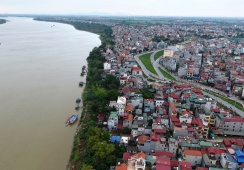
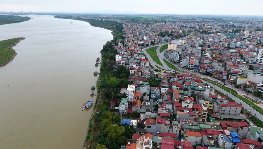
| Part of the Red River banks. Photo: Thanh Hai/The Hanoi Times |
At a conference on August 13, Nguyen Thi Ngoc Thanh, Vice Chairwoman of the Vietnam Union of Science and Technology Associations in Hanoi, emphasized that the section of the Red River flowing through Hanoi is relatively short—about 120 km compared to the total length of 1,200 km—but it plays a significant role and embodies a distinct cultural feature of the capital.
Thanh noted that the capital's planning up to 2030, along with adjustments to the master plan through 2045 and a vision for 2050, has recently identified a new breakthrough and perspective aimed at transforming the Red River area into a central landscape axis for the city.
“This plan envisages the harmonious development of ecological, cultural, and historical spaces, alongside modern urban areas, ultimately establishing it as a new symbol of Hanoi,” An said.
Architect Dao Ngoc Nghiem, Vice Chairman of the Vietnam Urban Development Planning Association, added that the areas on both banks of the Red River have always received significant attention.
Seven previous planning phases for the capital have seen adjustments made to leverage the potential and develop the river.
Nghiem said that while the 1992 master plan focused primarily on ensuring residential safety and flood evacuation, the 1998 plan began to emphasize the utilization of land along the riverbanks. The 2011 master plan identified the Red River as a central landscape axis, earmarking it for parks, cultural facilities, and significant sites for hosting major events in the capital. In 2022, the city approved the zoning plan for the Red River area (from Hong Ha Bridge to Me So Bridge) covering 11,000 hectares within the administrative boundaries of 55 communes and wards across 13 districts.
Nghiem, however, highlighted the need to address challenges in implementing these plans, particularly in ensuring flood safety.
“Given the river's characteristics and the impacts of climate change, it is imperative to conduct comprehensive studies in the areas of security, defense, regional connectivity, and science and technology to adapt to the changing river dynamics, ensuring safe water flow and sustainability of construction projects,” he noted.
Additionally, there is a pressing need to exchange knowledge and learn from experiences of previously proposed projects along the Red River that have not been implemented for both subjective and objective reasons. Importantly, attracting investment linked to specialized policies is crucial for creating breakthrough resources, he continued.
Associate Professor Dr. Nguyen Manh Kinh, Chairman of the Khương Mai District Technical Science Association, believed that a good plan must maximize the potential of resources for sustainable development. To achieve this, the plan must successfully address the management of the planning process itself, he stressed.
For the Red River plan, it is necessary to institutionalize, or even legislate, the requirements for managing both water and land areas, clearly defining the responsibilities and authority of management entities.
Regulations must be established regarding the responsibilities of the approving authorities, including monitoring the implementation of the plan (inspection frequency, level of scrutiny, progress tracking, and associated sanctions) to avoid the issue of "planning on paper."
Finally, he concluded that it is essential to ensure transparency and openness throughout the entire planning process, from design to approval and implementation.