Vietnam's coastal provinces requested to brace for Typhoon Fung-wong
Typhoon Fung-wong has intensified with maximum winds of up to 183 kilometers per hour (kph), called unusual late-season typhoon by Vietnam's National Center for Hydro-Meteorological Forecasting (NCHMF).
THE HANOI TIMES — The Ministry of Agriculture and Environment has asked coastal localities and relevant ministries to proactively cope with Typhoon Fung-wong after it entered the East Sea on November 10.
Nguyen Hoang Hiep, the ministry's deputy head, has asked five ministries in charge of public security, national defense, construction, science and technology, foreign affairs, as well as 13 coastal provinces and cities from Quang Ninh to Gia Lai, to be on full alert and ready to tackle with the typhoon.

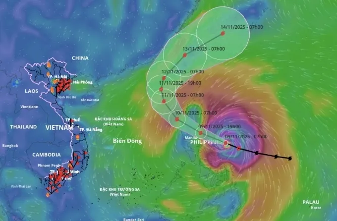
The predicted trajectory of storm Fung-wong on November 10. Source: NCHMF
Local authorities are tasked with notifying vessels and boats operating at sea to avoid danger and conducting timely response to any potential emergencies.
Nguyen Van Huong, Head of the Weather Forecasting Division at the NCHMF, described Fung-wong as an "unusual late-season typhoon."
He said that storms at this time of year typically move west or west-southwest toward south-central Vietnam. However, as Fung-wong enters the East Sea, the northern subtropical ridge allows upper-level westerly winds to push the storm northeastward and out of the East Sea.
"While direct impact on Vietnam is currently considered unlikely, the country should still stay alert for indirect effects, especially on the sea, coastlines and weather in offshore zones," said Huong.
This new storm comes as Vietnam is still recovering from Typhoon Kalmaegi, which made landfall in the central region on November 7, claiming nine lives, injuring 26 and inundating more than 103,000 houses, with total economic losses estimated at VND7.6 trillion (US$289 million).

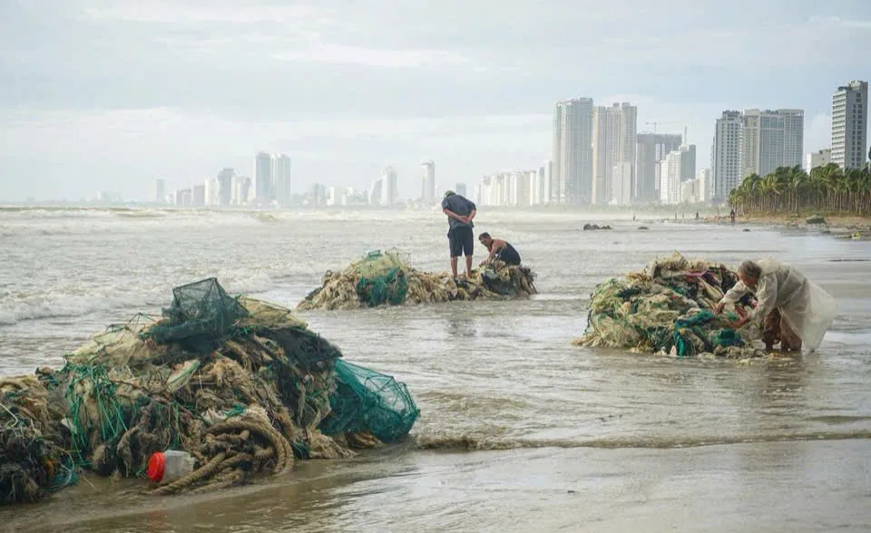
Fishermen in the central city of Danang collect nets damaged by Typhoon Kalmaegi. Photo: baodanang.vn
The East Sea has recorded 13 typhoons and five tropical depressions since the beginning of 2025, making this year the second-most active storm year in 30 years, behind only 2017. Storms including Wutip, Wipha, Matmo and Kalmaegi have all caused major floods across northern and central Vietnam.
|
As of 10 AM on November 10, Typhoon Fung-wong was located in the northern waters of the East Sea. Maximum sustained winds near the eye of the storm are at 149 kph. By 10 AM on November 11, the storm is forecast to keep its strength and track over the next 24 hours before weakening and turning north-northwest. By 10 AM on November 12, the storm’s core will be over the northeastern waters of the East Sea. It will change direction again toward the northeast, moving at a faster speed of about 25-30 kph and weakening into a tropical depression. Due to the impact of Typhoon Fung-wong, sea waves in affected zones will range from 5m-8m high, and 10m in areas close to the storm’s eye. The sea will be extremely rough. All vessels operating in these hazardous areas are at risk of severe thunderstorms, waterspouts, strong winds and high waves. |


