Vietnam’s central localities face flash floods as Typhoon Fengshen approaches
Central Vietnam is bracing for days of torrential rain, which may persist until the end of October, due to the circulation of Typhoon Fengshen.
THE HANOI TIMES — Vietnam’s central localities, including cities of Hue and Danang, face high risks of flash floods and landslides as Typhoon Fengshen threatens to dump up to 900mm of rainfall in three days after it makes landfall in the mainland tonight [October 23].
According to Mai Van Khiem, Director of the National Center for Hydro-Meteorological Forecasting, Fengshen’s winds are expected to peak at 102 kilometers per hour (kph) on October 23 afternoon and will not intensify after nearing land, unlike past storms such as Bualoi and Matmo.
"As Fengshen reached Vietnam's Hoang Sa Islands, cold air from the north slowed it down and forced it to change direction. Its circulation is drawing in large amounts of moisture from the East Sea, combining with strong winds. This convergence is expected to unleash prolonged heavy rainfall across central Vietnam, even after the storm disappears," said Khiem.

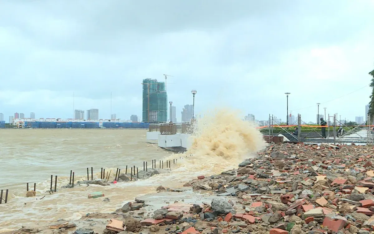
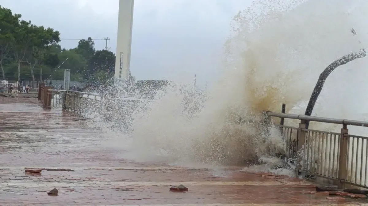
Massive waves erupt as they hit the sidewalks in the central city of Danang on October 21 as Typhoon Fengshen approaches Vietnam. Photos: Danang Newspaper
Rainfall will come in two phases. From October 23 to 24, the central province of Quang Tri to Danang could see 600mm of rain, with some areas exceeding 800mm and downpours of over 200mm within three hours.
Khiem warned that the first wave of rain poses a high risk of flooding in urban and industrial areas due to slow drainage caused by storm surges.
A second rain phase between October 25 and 27 will bring another 300mm to the central cities of Hue and Danang, with local totals surpassing 500mm. Rainfall across the region from now until the end of October is forecast to exceed the annual average by 20%-40%.
"Rivers in the two cities have already risen above flood alert levels due to earlier rain. From October 23 night through October 28, major rivers will surge above Level 3 (the highest level) flood alerts, threatening widespread inundation," Khiem noted.
He stressed that the intensity and duration of rain, possibly 500mm to 700 mm in total, could overwhelm drainage systems and trigger flash floods in mountainous areas. The affected localities need to ensure safety for hydroelectric and irrigation reservoirs before, during and after the storm, and prepare flood response plans for all rivers from Quang Tri to Quang Ngai.
“Precautions are also necessary against thunderstorms and tornadoes with strong gusts during the storm’s approach and landfall,” he said.

Waves up to 6m high batter the Han River embankment in the central city of Danang, tearing up sidewalks as Fengshen nears Vietnam's coast.
Formed east of the Philippines on October 18, Fengshen entered the East Sea on October 19 and became the 12th storm of 2025 in the waters.
Under the impact of a cold air mass, the typhoon weakened into a tropical depression at 10 PM on October 22, around 130km off Danang, with wind speed weakening from 75kph to 61 kph.
By October 23 night, the typhoon is expected to weaken as it moves over the waters off Hue and Danang, making landfall late tonight or early on October 24 as a tropical depression before disappearing over southern Laos.
Vietnam Airlines canceled at least 10 domestic flights and rescheduled eight others on October 22-23 as storm Fengshen brought heavy rain and strong winds to central Vietnam, disrupting operations in Hue and Danang and causing delays to international routes.

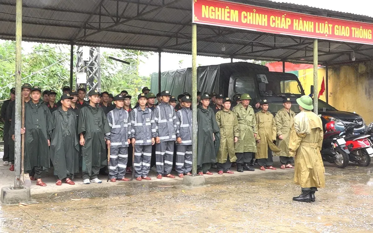
The central province of Quang Tri mobilizes over 5,000 armed officers on standby to cope with Typhoon Fengshen. Photo: Quang Tri Newspaper
Prime Minister orders emergency response
Prime Minister Pham Minh Chinh on October 22 requested ministries and localities to mobilize all resources to cope with heavy rain, flooding and landslides in the central region.
The Government leader asked key ministries, agencies and localities in Ha Tinh, Quang Tri, Hue, Danang and Quang Ngai to postpone non-essential meetings and focus on storm response, including proactive drainage, reservoir management and emergency preparedness.
He urged ensuring vessel and fisher safety, identifying high-risk areas for evacuation, supporting vulnerable groups and suspending classes or restricting traffic in flooded zones to protect lives and property.


