Ring road No.4 offers Hanoi chances for economic breakthroughs
The project holds significant meaning for socio-economic development in Hanoi and the country overall.
Creating new development spaces, making full use of the land potential, and developing a sustainable urban network for the reallocation of residents in downtown areas are among the major objectives of the Ring-road No.4 project.
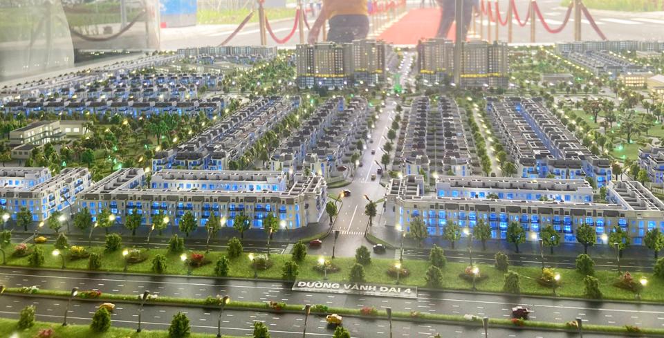
| Planning of an urban residential area in Me Linh District alongside the Ring road No.4. Photo: Pham Hung |
Ring road No.4 runs112.8 kilometers through 14 districts from three northern cities/provinces, including Hanoi, Hung Yen, and Bac Ninh.
In Hanoi, it would crosses seven urban and rural districts for 58.2 kilometers, including Soc Son, Me Linh, Dan Phuong, Hoai Duc, Thanh Oai, Thuong Tin, and Ha Dong.
At present, local authorities in districts under the project areas are in the preparation for site clearance.
Me Linh, one among seven districts in Hanoi where the Ring road No.4 runs 11.2 kilometers needs a site clearance area of nearly 193 hectares, including 8.6 hectares of urban areas, and 180 hectares of agricultural land.
Chairman of Me Linh District People’s Committee Hoang Anh Tuan said the locality has set up a Steering Committee on site clearance and resettlement tasks.
“The priority is to enhance land management and construction discipline in the area. Me Linh District has identified locations for resettlement plan and would proceed with the construction to ensure the soon settlement of households affected by the project,” Tuan told The Hanoi Times.
Similarly to Me Linh, other districts such as Soc Son, Thuong Tin, Thanh Oai, and Ha Dong are carrying out the site clearance works promptly.
Not only the authorities have been actively involved in the project, but also the people in the project area, as they are hoping for the early construction of the No.4 bypass road.
Ngo Phu Luong, a local at Noi Dong Village, Dai Thinh Ward, Me Linh District, said Ring road No.4 holds significant meaning to the socio-economic development of the locality in particular, and Hanoi in general, as such, his family and others in the village are willing to handover their lands so that the construction could start soon.
Urban development to upgrade rural districts
The Hanoi Urban Planning Institute has been assigned the task of adjusting Hanoi’s construction planning until 2030, with a vision for 2050.
A key task in this process is to outline the development vision for new spaces to the east of Ring Road No.4 and west of the Red River.
According to the Institute Director Luu Quang Huy, the agency is focusing on the planning for socio-economic infrastructure development in several rural districts subject to be transformed into urban ones during the 2025-2030 period.
“The goal is to ensure green and sustainable urban development in two areas alongside the Ring road No.4, creating a transition space between the urban and rural areas,” Huy told The Hanoi Times.
In addition, Huy expected Hanoi would expand its downtown areas westward to better utilize land resources alongside Ring road No.4, focusing on the construction of transport infrastructure, parking lots, railway stations, green spaces, and underground spaces.
On this issue, Hanoi expected three rural districts to be transformed into the urban district, namely Me Linh, Dong Anh, and Soc Son.
Representative of Me Linh District said the locality has proposed the city incorporate its development plan for urban, industry, commerce, and services into the overall construction planning of Hanoi.
“Me Linh plans to construct major roads connecting to new development areas and build a large-scale logistics center,” he said.
As such, a road running from Me Linh to Noi Bai Airport would help promote logistics efficiency. West of Ring road No.4, over 1,000 hectares are available for industrial development.
Chairman of Thanh Oai District People’s Committee Bui Van Sang said the locality expects to develop several urban areas alongside the Ring road No.4, together with parks, parking lots, playing grounds, logistics services, hospitals, and showrooms for craft products.
By 2025, the district would become an urban ecosystem and hi-tech farming area; a growth engine for Hanoi’s southwest toward a green, modern and smart vision.
| “The development of two areas alongside Ring road No.4 would help relocate the people living in the downtown area for greater land utilization. Urban growth should be under the transport-oriented development (TOD) model,” said Hanoi Urban Planning Institute Director Luu Quang Huy. |


