Hanoi eyes raising planning quality via digitalization
Digital solutions would help the city address existing problems during the urban planning and management process.
The application of Geographic information systems (GIS), digital techs, and platforms are seen as solutions for Hanoi to further improve planning quality.
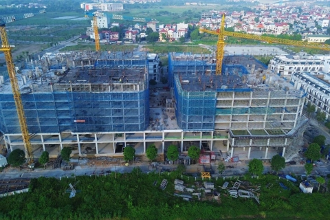
| Hanoi is using GIS in the planning development process. Photo: Nguyen Van |
.png)
Within the framework of Hanoi's overall construction planning issued by the Prime Minister in 2011, local authorities have pushed for the development of different plans, such as zoning and detailed plans, urban design, renovation and management, as well as urban heritage conservation.
However, rapid urbanization has exposed shortcomings during urban planning and management, leading to difficulties during the implementation.
The lack of a legal mechanism to transform planning into action plans has also led to many unfinished businesses, such as the planning of five satellite cities (Soc Son, Son Tay, Hoa Lac, Xuan Mai and Phu Xuyen).
Many experts have also voiced concern over the low quality and impractical planning, subject to time-consuming adjustments.
Meanwhile, violations during the construction process have not been adequately addressed due to oversight limitations.
Dinh Tuan Hai, a professor at the Building Department of Hanoi University of Architecture, pointed to digitization as a solution to solve problems during planning.
“Modern and accurate technical management tools would help the authorities to make the right decision for sustainable urban development,” Hai told The Hanoi Times.
Hai expected the city to soon integrate two databases in planning and urban management, as well as apply GIS to ensure consistent management in terms of planning-architecture – construction–urban development.
“This is particularly important with the use of GIS, a computer system that analyzes and displays geographically referenced information,” Hai said, expecting the move to support the authorities in improving efficiency in urban planning, design, and management.
Vice Director of the Academy of Managers for Construction and Cities (AMC) under the Ministry of Construction Luu Duc Minh said the GIS remains an essential tool for Government agencies and localities to promote urban development according to planning and is being used widely around the world.
Digitalization is an urgent matter
Hanoi Urban Planning Institute (HUPI) director Luu Quang Huy said the agency is using GIS to develop a database of different plans, from general to zoning to specialized plans, the results of which could be used as inputs to analyze and report.
“Such databases have become the basis for urban management and construction,” Huy told The Hanoi Times.
This is particularly important as Hanoi is making an overall plan that integrates different economic sectors and fields, such as construction, transport, environment, and water provision.
“Urban planners would have a better view of the overall situation and make the right decision in this process, and local agencies will supervise the planning implementation with greater efficiency,” he continued.
Minh from the AMC referred to Vietnam’s smart and sustainable development in the 2018-2025 period, with a vision for 2030, that includes the goal of developing a database for smart city projects.
“The application of GIS, digital tech, and platforms are, therefore, key in any planning process,” Minh told The Hanoi Times.